Viktor Jung · 8 September 2026
River Conservation Advances Through University Partnerships in Ashberg District
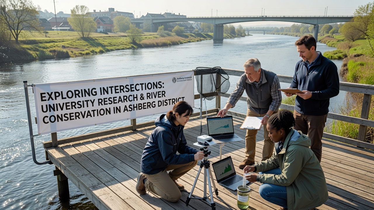
University research programs have intersected with river conservation initiatives across Ashberg District through collaborative monitoring projects and data analysis that track water quality alongside habitat changes. Local waterways face pressures from agricultural runoff and urban development, yet partnerships between academic institutions and conservation groups have generated datasets that inform targeted restoration strategies. These efforts rely on long-term sampling protocols established by faculty and students who collect sediment, nutrient, and biodiversity metrics at multiple sites along the district's main river corridors.
Research Methods Driving Local Projects
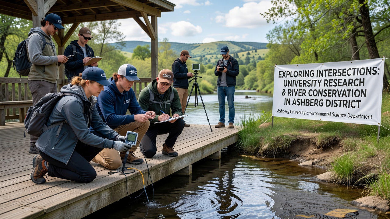
Teams from nearby universities deploy sensor networks and drone surveys to map erosion patterns while measuring dissolved oxygen levels and macroinvertebrate populations in real time. Data collected over several seasons reveal seasonal spikes in phosphorus concentrations that correlate with upstream farming cycles, allowing conservation planners to prioritize buffer zone installations along vulnerable banks. Observers note that these quantitative approaches replace earlier anecdotal assessments with measurable benchmarks that guide funding allocations from regional environmental agencies.
Graduate students often contribute specialized analyses, such as modeling flood resilience under varying precipitation scenarios, which feed directly into district management plans. One ongoing study examines how riparian vegetation restoration influences fish migration routes, using tagged specimens and acoustic receivers to document movement patterns before and after planting phases. Results from these investigations appear in peer-reviewed journals and shape grant proposals submitted jointly by university departments and local nonprofits.
September 2026 Milestones and Fieldwork Expansion
September 2026 marks the launch of an expanded monitoring phase that incorporates additional sensor arrays upstream from Ashberg’s central river bend, where earlier data indicated elevated nitrate inputs. Researchers plan to integrate satellite imagery with ground-truthing visits scheduled throughout the month, aiming to refine predictive models for algal bloom events that have affected recreational access in past years. Workshops scheduled for mid-September will bring together hydrologists, ecologists, and district officials to review preliminary findings and adjust intervention timelines accordingly.
Equipment upgrades funded through academic-industry agreements will enable continuous telemetry on temperature fluctuations that influence native species survival rates. Those coordinating the work emphasize the value of cross-institutional data sharing, which reduces duplication and accelerates the identification of pollution hotspots. Field crews expect to complete baseline surveys by late September, establishing reference conditions against which future restoration outcomes can be evaluated.
Policy Applications and Regional Comparisons
Findings from these university-led initiatives have informed updates to local waterway protection ordinances, particularly rules governing setback distances for new construction near riverbanks. District planners reference sediment load calculations generated by academic models when evaluating permit applications, ensuring decisions rest on empirical thresholds rather than generalized guidelines. Similar intersections between research and policy appear in other European regions, where agencies such as the European Environment Agency publish comparable water framework assessments that highlight successful academic contributions to conservation outcomes.
Comparative studies with districts in Canada show parallel patterns, where university partnerships accelerate adoption of precision agriculture techniques that lower nutrient runoff. Data shared through international networks allow Ashberg researchers to adapt proven methods to local soil types and river morphology. Reports from the U.S. Environmental Protection Agency further illustrate how sustained academic involvement strengthens adaptive management frameworks across varied geographic contexts.
Community Involvement and Long-Term Monitoring
Residents participate in citizen science components that supplement professional sampling efforts, submitting observations on shoreline vegetation changes via standardized apps developed by university IT teams. Training sessions held at district community centers teach volunteers proper data recording techniques, improving the reliability of crowd-sourced inputs that feed into central databases. These programs build public awareness while expanding the spatial coverage of monitoring beyond what limited research budgets could achieve alone.
Long-term datasets accumulated through these partnerships now span multiple years, revealing trends in macroinvertebrate diversity that correlate with reduced agricultural inputs following targeted outreach campaigns. Analysts continue to refine statistical tools that isolate the effects of specific interventions, such as constructed wetlands installed at tributary junctions. Such refinements support evidence-based adjustments to annual work plans issued by the district conservation authority.
Conclusion
University research continues to intersect with river conservation in Ashberg District through sustained data collection, modeling, and community engagement that translate academic findings into actionable management steps. September 2026 activities will extend existing sensor networks and convene stakeholders to align upcoming phases with emerging evidence. External sources including the European Environment Agency and U.S. Environmental Protection Agency provide comparative frameworks that contextualize local progress within broader regional patterns. These intersections demonstrate how systematic academic involvement supports measurable improvements in waterway conditions over time.